Looking at a map of Italy can be invaluable when planning your route around the country.
You see where the major attractions are in relation to each other, making it easier to structure your itinerary.
Where should you go? In what order? And is there anything interesting to see on the way?
Maps of Italy can provide answers to those kinds of questions. Here’s a collection of Italy maps that I’ve created to help!
Map of Italy’s Cities
How these maps work: Click each location on the map for more information. Click the little star next to the map’s title (it will turn gold) to add it to your own Google Maps account. To view it, open Google Maps, click on “Saved” in the menu, then go to the “Maps” tab. It should appear there.
Italy has some of the finest cities in Europe. They’re full of history, culture, amazing medieval architecture, and iconic attractions.
In this map, I’ve highlighted 30 Italian cities to consider visiting. Some, like Rome, Venice, and Florence, are world-famous. Others, such as Aosta and Lecce, arguably fall into the “hidden gem” category. Almost all boast a timeless allure and diverse list of things to do.
This map also shows Italy’s 20 administrative regions (I thought it might be helpful to see which one each city falls into). To see them, hit the Menu icon in the top left, scroll down, and then tick the “Italy’s Regions” button.
Map of Italy’s Regions
This map of Italy shows its 20 administrative regions. From the Aosta Valley in the far northwest to Apulia (otherwise known as Puglia) in the southeast and the two major islands off its coast (Sicily and Sardinia), you can hover your mouse over each area to see where everything is.
Just a heads up that I’ve created these manually, so they’re not perfect! I only intended this Italy map to be a guide – a rough outline of each region.
Italy Map Showing Its Major Parts
Bel Paese is also divided into four overarching regions: northern Italy, southern Italy, central Italy, and the Italian islands.
Like the previous two maps of Italy, this one shows its 20 administrative regions. But if you click on the menu in the top left, you can scroll down and select the different parts of the country. That way, you can see which administrative regions are in northern, southern, and central Italy or its islands.
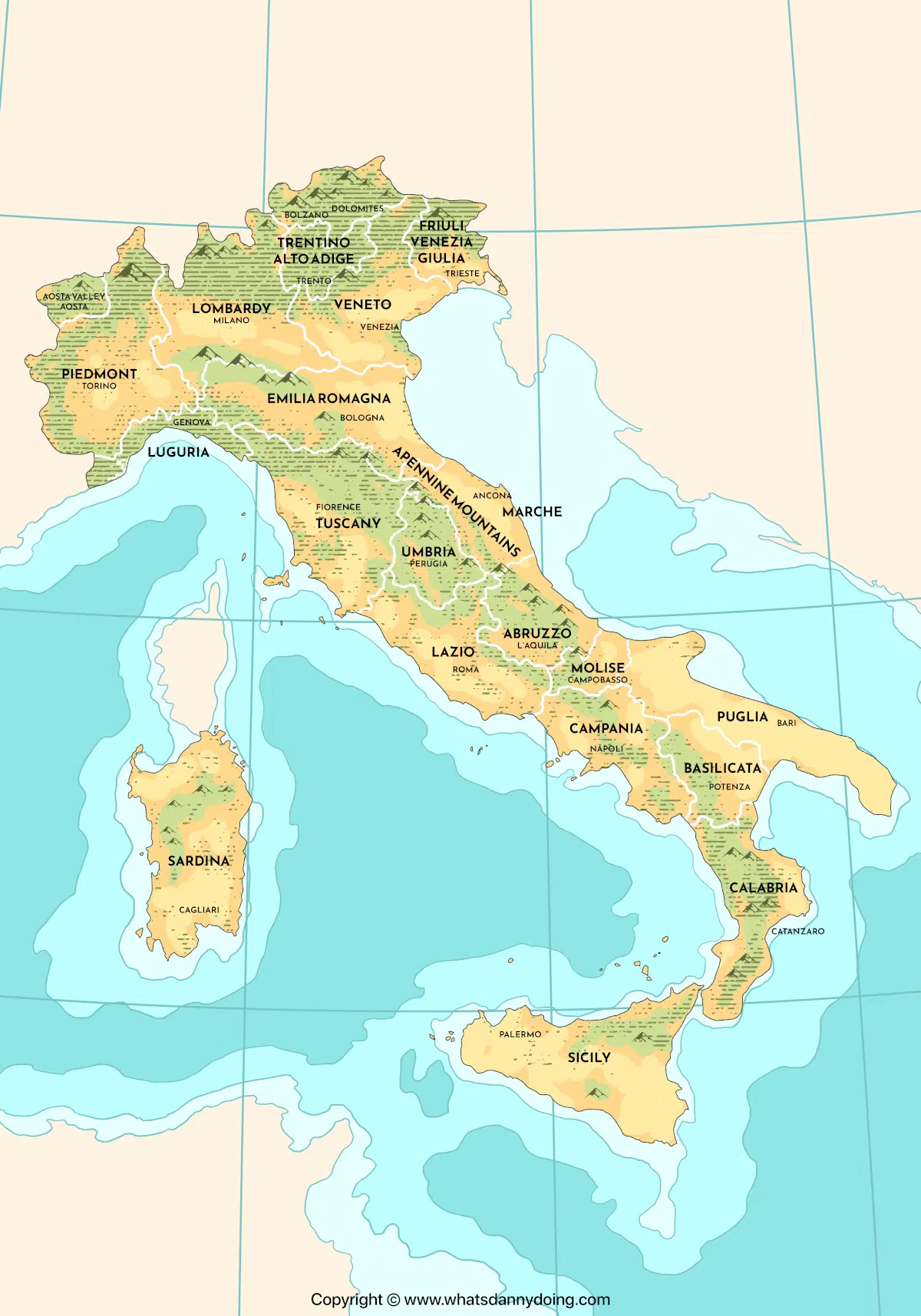
Basic Map of Italy

I figured some people might not want a digital map of Italy to put on Google Maps! So here’s a different style of map I paid someone to create for me. It shows most of Italy’s main cities and regions. You can download it here.
Maps of Italy to Download and/or Display


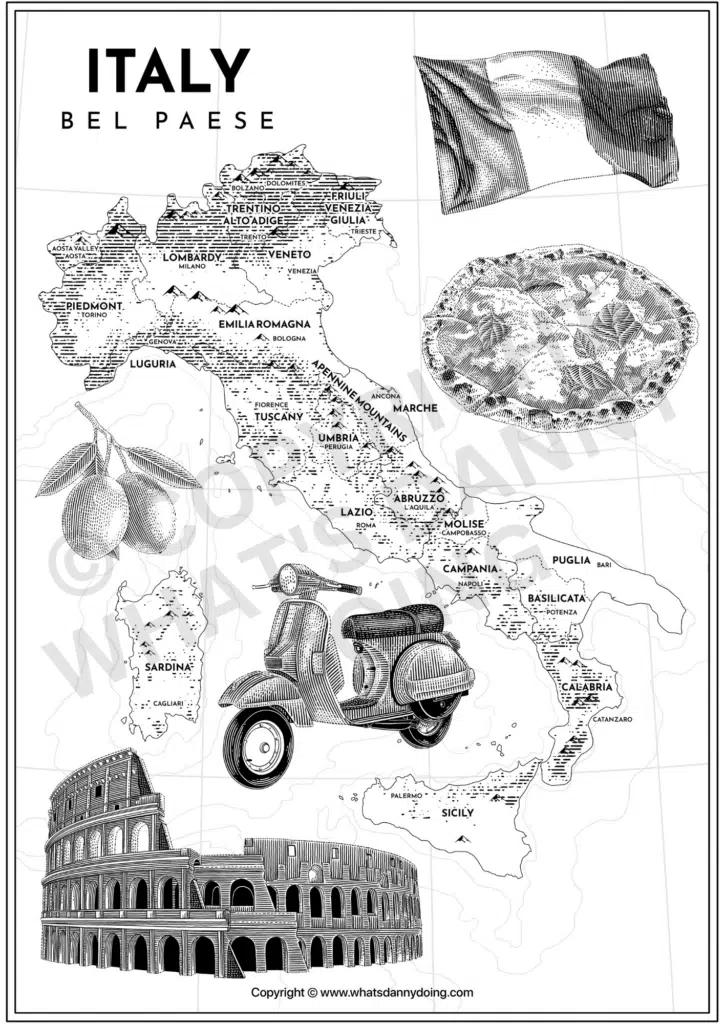
Love Italy as much as I do? You might be interested in these Italy map posters I’ve made for you to download and print to display at home.
The black-and-white poster is totally free (download your copy here). If you’d like the full-colour version, head over to my Etsy store, where it’s currently on sale for a few bucks. And click here to buy a beautiful framed copy to display at home or gift to a loved one.
Bookmark These Italian Maps
Whether you’re planning your trip around Bel Paese or simply want to know more about where things are there, I hope you’ve found this map of Italy collection useful!
I intend to keep adding to it over time to include more than just its cities and regions. Until then, here’s a list of unmissable things to do in Italy. Check it out for more ideas on where to go and what to see while you’re there!